


Berlin Precinct, Otoe County, Nebraska
About
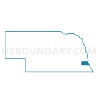
Outline

Summary
| Unique Area Identifier | 613680 |
| Name | Berlin Precinct |
| County | Otoe County |
| State | Nebraska |
| Area (square miles) | 72.10 |
| Land Area (square miles) | 71.73 |
| Water Area (square miles) | 0.37 |
| % of Land Area | 99.48 |
| % of Water Area | 0.52 |
| Latitude of the Internal Point | 40.74391220 |
| Longtitude of the Internal Point | -96.12432060 |
Maps


Graphs
Select a template below for downloading or customizing gragh for Berlin Precinct, Otoe County, Nebraska


Neighbors
Neighoring Voting District (by Name) Neighboring Voting District on the Map
- Avoca Precinct, Cass County, NE
- Delaware Precinct, Otoe County, NE
- Four Mile Precinct, Otoe County, NE
- N. Syracuse Precinct, Otoe County, NE
- Nehawka Precinct, Cass County, NE
- Russell Precinct, Otoe County, NE
- Stove Creek Precinct, Cass County, NE
Top 10 Neighboring County Subdivision (by Population) Neighboring County Subdivision on the Map
- Syracuse precinct, Otoe County, NE (2,270)
- Stove Creek precinct, Cass County, NE (992)
- Avoca precinct, Cass County, NE (596)
- South Russell precinct, Otoe County, NE (520)
- Wyoming precinct, Otoe County, NE (424)
- Belmont precinct, Otoe County, NE (411)
- Delaware precinct, Otoe County, NE (407)
- Nehawka precinct, Cass County, NE (379)
- North Branch precinct, Otoe County, NE (376)
- Berlin precinct, Otoe County, NE (242)
Top 10 Neighboring Place (by Population) Neighboring Place on the Map
Top 10 Neighboring Unified School District (by Population) Neighboring Unified School District on the Map
- Nebraska City Public Schools, NE (9,241)
- Syracuse-Dunbar-Avoca Schools, NE (4,454)
- Conestoga Public Schools, NE (4,176)
- Weeping Water Public Schools, NE (1,873)
Top 10 Neighboring State Legislative District Upper Chamber (by Population) Neighboring State Legislative District Upper Chamber on the Map
Top 10 Neighboring 111th Congressional District (by Population) Neighboring 111th Congressional District on the Map
Top 10 Neighboring Census Tract (by Population) Neighboring Census Tract on the Map
- Census Tract 9659, Cass County, NE (4,998)
- Census Tract 9660, Cass County, NE (4,301)
- Census Tract 9667, Otoe County, NE (3,113)
- Census Tract 9668, Otoe County, NE (2,893)
- Census Tract 9666, Otoe County, NE (2,128)
Top 10 Neighboring 5-Digit ZIP Code Tabulation Area (by Population) Neighboring 5-Digit ZIP Code Tabulation Area on the Map
- 68410, NE (8,716)
- 68446, NE (2,690)
- 68349, NE (1,098)
- 68454, NE (625)
- 68413, NE (533)
- 68307, NE (515)
- 68346, NE (493)
- 68417, NE (292)